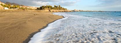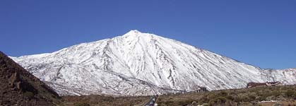
In Tenerife, Spain, you can find unbeatable hiking routes winding up and down hills, through unspoiled wilderness and along the shoreline. Take a hike and check out the jaw-dropping Los Gigantes cliffs, explore the spectacular pine forests of La Orotava, or venture through the northeastern Anaga Mountains. However, the real gem of the island - and possibly of Spain - comes in the form of Mount Teide. The colossal mountain - it's the biggest in Spain - is the centerpiece of the incredible Mount Teide National Park.
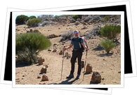
A massive network of trails going up, down and all around the peaks, hill sides and volcanic formations of Mount Teide National Park have been grouped by the National Park Office Management into 12 major hike routes. The routes vary both by lengths and difficulties, making the views of the surrounding mountains, of the landscapes and even of the neighboring islands La Gomera and El Hierro readily available to hikers of all levels.
Portillo de la Villa - Los Riscos de la Fortaleza Trail
One-way or circuit: One-way
Starting point: Portillo de la Villa visitor's center
Ending point:
Los Riscos de la Fortaleza
Difficulty: Low
Distance: 5.3 kilometers
Time: 1 hour, 45 minutes
Arenas Negras Trail
One-way or circuit: Circuit
Starting point: Portillo de la Villa visitor's center
Ending point: Portillo de la Villa vistor's center
Difficulty: Low
Distance: 7 kilometers
Time: 3 hours
Roques de García Trail
One-way or circuit: Circuit
Starting point: La Ruleta viewpoint
Ending point: La Ruleta viewpoint
Difficulty: Low
Distance: 3.5 kilometers
Time: 2 hours
Siete Cañadas Trail
One-way or circuit: One-way
Starting point: Portillo de la Villa visitor's center
Ending point: Cañada Blanca visitor's center
Difficulty: Low
Distance: 15 kilometers
Time: 5 hours
Degollada de Guajara Trail
One-way or circuit: One-way
Starting point: Cañada Blanca visitor's center
Ending point: Degollada de Guajara
Difficulty: High
Distance: 4.5 kilometers
Time: 3 hours
Montaña de los Tomillos Trail
One-way or circuit: One-way
Starting point: Portillo de la Villa visitor's center
Ending point: Montaña Blanca
Difficulty: Average
Distance: 7.5 kilometers
Time: 2 hours, 30 minutes
Montaña Blanca Trail
One-way or circuit: One-way
Starting point: Kilometer 40.2 of Road TF-21
Ending point: La Rambleta viewpoint
Difficulty: High
Distance: 10 kilometers
Time: 6 hours, 30 minutes
Filo Trail
One-way or circuit: One-way
Starting point: Kilometer 38.5 of Road TF-24
Ending point: Cañada Blanca visitor's center
Difficulty: Average
Distance: 18 kilometers
Time: 9 hours
Teide - Pico Viejo - Road TF-38 Trail
One-way or circuit: One-way
Starting point: La Rambleta viewpoint
Ending point: Kilometer 3.2 of Road TF-38 (Chahorra viewpoint)
Difficulty: Extreme
Distance: 12 kilometers
Time: 8 hours
Pico del Teide / Telesforo Bravo Trail
One-way or circuit: One-way
Starting point: La Rambleta viewpoint
Ending point: Pico del Teide
Difficulty: High
Distance: 700 meters
Time: 40 minutes
La Fortaleza Viewpoint Trail
One-way or circuit: One-way
Starting point: La Rambleta viewpoint
Ending point: La Fortaleza viewpoint
Difficulty: Average
Distance: 600 meters
Time: 25 minutes
Pico Viejo Viewpoint Trail
One-way or circuit: One-way
Starting point: La Rambleta viewpoint
Ending point: Pico Viejo
Difficulty: Average
Distance: 700 meters
Time: 30 minutes